Flood Risk Assessment
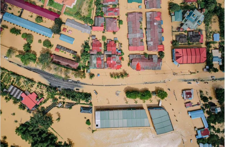
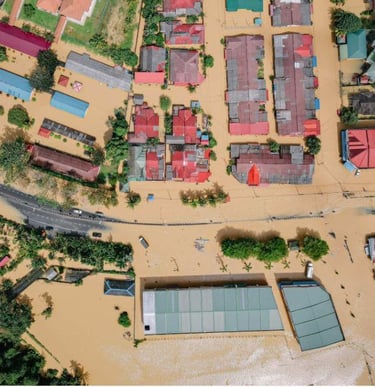
Floods are among the most destructive and costly climate-related disasters worldwide, causing billions of dollars in damage every year while threatening critical infrastructure, economic stability, public safety, and territorial resilience. As climate change intensifies rainfall variability and extreme weather events, flood exposure is increasing dramatically across urban areas, river basins, coastal regions, and industrial corridors.
Today, more than 1.8 billion people are estimated to live in areas exposed to significant flood risk, while flood-related economic losses exceed $80–100 billion annually worldwide. In recent decades, extreme precipitation events have increased in both frequency and intensity, overwhelming drainage systems, reservoirs, dams, transport infrastructure, and urban water networks. The consequences often extend far beyond immediate physical damage, generating supply chain disruptions, industrial shutdowns, energy instability, agricultural losses, insurance pressure, and long-term socio-economic impacts.
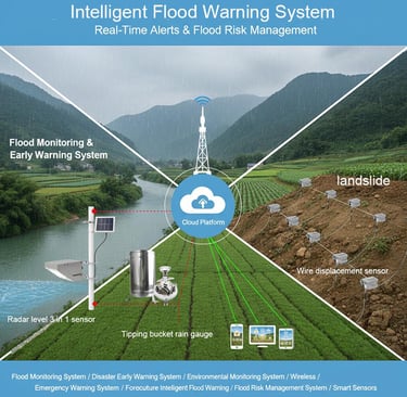
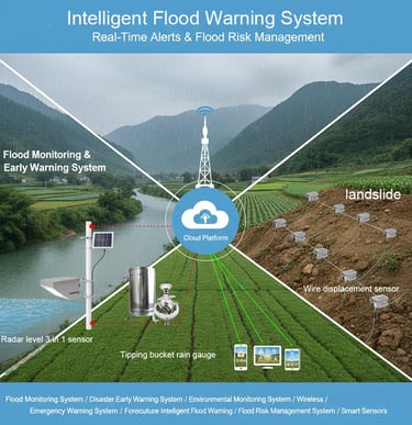
Aegir Resilience addresses these challenges through an advanced Flood Risk Assessment system designed to identify flood vulnerability before critical events occur. The platform integrates satellite imagery, rainfall projections, hydrological models, river discharge data, topographical analysis, IoT monitoring systems, and historical climate patterns into a unified predictive framework capable of detecting emerging flood threats in real time.
Using AI-driven forecasting and predictive analytics, the system continuously evaluates rainfall anomalies, watershed stress, drainage capacity, reservoir overflow probability, and infrastructure exposure to estimate where and when flood conditions may intensify. Dynamic risk maps and scenario simulations allow decision-makers to visualize vulnerable zones, anticipate cascading impacts, and prepare mitigation strategies before emergency thresholds are reached.
The platform also monitors the resilience of dams, pipelines, reservoirs, aqueducts, and critical infrastructure systems exposed to hydro-climatic stress. By identifying operational vulnerabilities and high-risk hotspots in advance, Aegir Resilience enables governments, utilities, insurers, industries, and infrastructure operators to reduce downtime, strengthen preparedness, optimize emergency planning, and protect communities from escalating climate-driven flood events.
In an era of increasing environmental volatility, flood prediction is no longer simply a reactive emergency management tool - it is becoming a strategic necessity for safeguarding infrastructure, economies, territorial stability, and human security..


Reach us
filippo.verre@aegirresilience.com
Request a technical briefing
Response within one business day
(C) 2026 Aegir Resilience - Predict to Prevent
Weeks ahead — not hours behind